
Shaker Heights ZIP Code Coverage
Three verified ZIPs serve Shaker Heights: 44118, 44120, and 44122. The County’s MyPlace results confirm a Shaker Heights address in each one. That is stronger evidence than a generic ZIP list, but it still does not turn a postal ZIP into a municipal boundary. The postal directory is most useful when it keeps delivery routing, City jurisdiction, and parcel identity separate from the beginning.
| ZIP | Areas Covered | Post Office | Notes |
|---|---|---|---|
| 44118 | MyPlace returns Shaker Heights, 44118 for 19001 Shelburne Rd.; the postal geography also reaches nearby Cleveland Heights. | Nearby Cleveland Heights facility in the USPS listing | Verify the individual address. A shared postal ZIP is not a City-limit line. |
| 44120 | MyPlace returns Shaker Heights, 44120 for 3400 Lee Rd. | Shaker Heights Post Office, 3675 Warrensville Center Rd., Cleveland, OH 44120-5200 | The postal-city line is Cleveland even where the delivery or community label is Shaker Heights. |
| 44122 | MyPlace returns Shaker Heights, 44122 for 3516 Warrensville Center Rd.; the postal geography is wider than the City. | Nearby Beachwood facility in the USPS listing | Address-specific verification is required before relying on the City field. |
Census geography associates Shaker Heights with the same three ZCTAs, or ZIP Code Tabulation Areas. A ZCTA is a Census statistical approximation, not a USPS delivery boundary. No authoritative City neighborhood-to-ZIP crosswalk or historic ZIP realignment chronology was located, so no neighborhood should be assigned to one ZIP by assumption.
USPS’s Shaker Heights Post Office record supplies the postal-facility context for the directory.
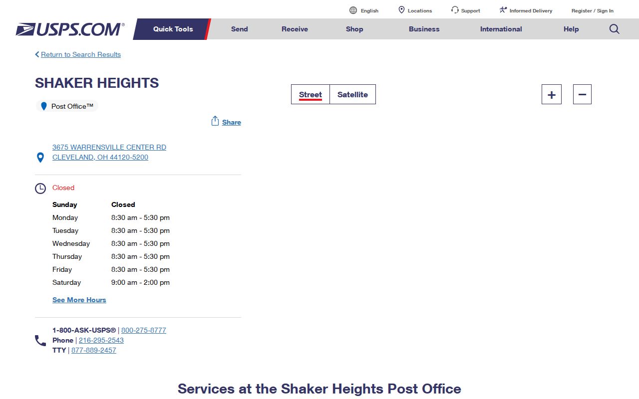
The facility listing is useful for postal services and address checks, but a post office entry does not define every City parcel within a ZIP.
Shaker Heights 44120 Postal Channel
ZIP 44120 is the locally named post-office channel in the research record. The Shaker Heights Post Office is listed at 3675 Warrensville Center Rd., Cleveland, OH 44120-5200, with telephone 216-295-2543. Its posted retail hours are Monday through Friday 8:30 a.m. to 5:30 p.m. and Saturday 9 a.m. to 2 p.m.; PO Box access is listed as 24/7. City Hall at 3400 Lee Rd. is a County property result in 44120, providing an address-level example rather than a rule for the entire City.
The Cleveland postal-city line is the local quirk. A document or mailing address can use Cleveland while the property lies in Shaker Heights. Confirm jurisdiction through the City field in MyPlace or the City recordholder, then preserve the mailing format the Postal Service recognizes. The reverse problem also occurs: an address sharing a ZIP may sit outside Shaker Heights.
Note: Postal-city wording and municipal jurisdiction can differ at the same address, so retain the source that supplied each label.
Shaker Heights ZIP Address Keys
A ZIP is only one address component. Cuyahoga property records distinguish the situs, or physical property address, from the owner mailing address, and both from the permanent parcel number and legal description. The situs identifies the parcel on the ground. The mailing address shows where the tax record is sent. The PPN and legal description are the durable keys for a Recorder title trail when an address display changes or a parcel is split.
| Situs address | The physical property address in MyPlace or GIS, including the parcel ZIP. It does not list all people at the address. |
|---|---|
| Owner mailing address | The correspondence destination in the tax record. It may be elsewhere and is not current-residence evidence. |
| Permanent parcel number | The county parcel identifier, also called PPN, used to connect property and Recorder research. |
| Legal description | The subdivision, lot, sub-lot, section, or condominium description that can remain useful when a street label changes. |
MyPlace is a free county information service. The County directs users to the underlying public office for the official record, so a result should lead to the custodian record when legal proof or a document image is needed.
Searching a Shaker Heights ZIP
There is no ZIP-only consumer resident search in MyPlace. Its public modes are Owner, Parcel, and Address, while ZIP appears in an individual property result. The Ohio voter form is also not a ZIP browse tool: it requires a first name, last name, and county, with a street-name selector after an initial result. For ZIP-based research, start with the exact address and choose the source that matches the record sought.
- Use USPS address verification to check the delivery-format ZIP for the exact street address.
- Open MyPlace, select City = Shaker Heights, choose Address or Parcel, and record the returned PPN, situs address, and displayed ZIP.
- For a property document trail, use the PPN or legal description in Cuyahoga Official Records Search rather than relying on ZIP alone.
- For a known person, use Ohio My Voter Information with the person’s name and Cuyahoga County, then treat the result as registration evidence rather than occupancy proof.
- Where a group of parcels is genuinely required for a civic or property question, use the technical GIS layer with City-boundary context and protect confidential records.
Once a verified ZIP narrows the area to a particular street, the Shaker Heights street directory lookup provides the address-keyed property and historical-record path.
Shaker Heights ZIP Query Fields
The Cuyahoga Fiscal GIS CAMA layer can support a technical parcel query using PAR_ZIP, but it is not a consumer directory. Its interface expects a meaningful query condition and can return parcel, situs, mailing, transfer, valuation, and geometry information. A county extract requires City-boundary interpretation because a ZIP condition alone includes postal geography beyond Shaker Heights.
| GIS field or control | Type | Required | ZIP research use |
|---|---|---|---|
| Where / Text / Object IDs | Query text | One meaningful criterion normally needed | Technical route for a condition such as a parcel ZIP or address component. |
| Out Fields | Text or multiselect | No | Select parcel, owner, transfer, situs, mailing, valuation, or map fields. |
| Geometry / Spatial Relationship / Distance | Map and spatial inputs | No | Helps limit a technical query to the relevant mapped area. |
| Return Geometry / Output Format | Toggles or dropdown | No | Controls map-coordinate and output handling, not a people search. |
Note: The GIS ZIP field can organize parcel data, but it cannot verify every current resident or override the Recorder’s controlling property documents.
Shaker Heights ZIP Geography Limits
ZIP codes, municipal limits, and ZCTAs answer different geographic questions. USPS assigns delivery routing; the City controls municipal jurisdiction; Census ZCTAs summarize an approximation for statistics. A Shaker Heights address can use a nearby postal-city label, while another address with the same ZIP can lie outside City limits. Confirm the exact address before requesting a City record or attributing a parcel to Shaker Heights.
- ZIP and ZIP+4
- A five-digit ZIP guides broad delivery routing. ZIP+4 adds a more precise delivery segment and still does not define a municipal boundary.
- PO Box ZIP
- A ZIP used for postal boxes. It identifies a mail service arrangement, not a property location or a residence list.
- Unique ZIP
- A ZIP assigned to a single organization or large recipient. The term describes a postal arrangement, not a neighborhood.
- Carrier route
- A delivery route within postal operations. It is not a City district, parcel boundary, or public household roll.
Shaker Heights Neighborhood Geography
Boulevard, Fernway, Lomond, Ludlow, Malvern, Mercer/Thornton Park, Moreland, Onaway, and Sussex are City-recognized neighborhood names. They help researchers describe local history or find association material, but they are not ZIP boundaries. The research did not locate an official neighborhood-to-ZIP crosswalk, so a city directory or property finding should name the verified address and ZIP instead of assigning a whole neighborhood to one postal area.
Census QuickFacts for Shaker Heights provides City-level context, separate from address-level postal verification.
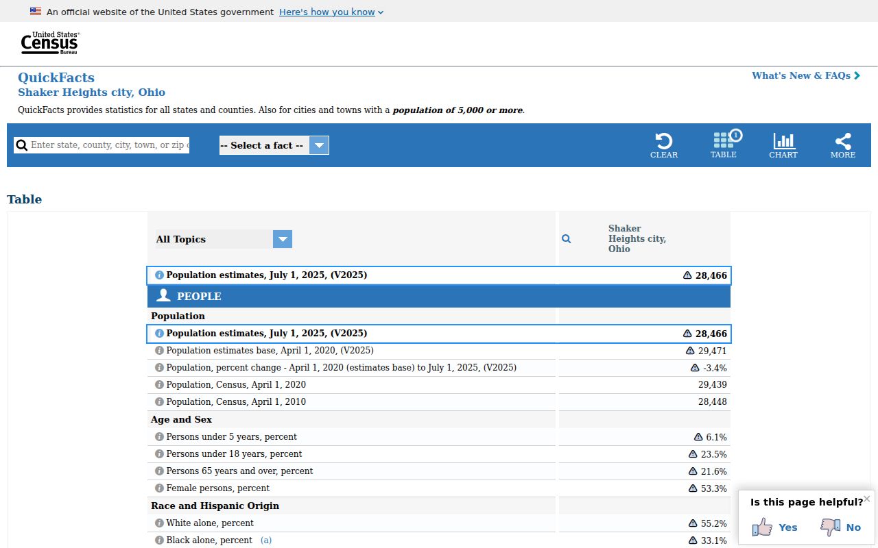
Citywide statistics describe the municipality as a whole. They do not map people, households, or neighborhood boundaries to an individual ZIP.
Shaker Heights ZIP Code Directory History
Historic address research should not project today’s ZIP geography backward. For an older street address, use the relevant city or suburban directory, the criss-cross address section, plat maps, the parcel PPN, and the legal description. Cleveland and most suburban directory volumes have address sections from 1929, while the dedicated five-suburb directory covers the documented Shaker Heights sequence from 1949 through 1963. Census records through 1950 supply another dated household layer.
The Census profile for Shaker Heights identifies the City with the three current ZCTAs but should not be used as an historic address map.
For historic work, retain the date and source with each address finding, then compare the location through the records system that existed at that time.
Note: Modern postal geography is a delivery reference, while older address research depends on the directory, map, parcel, or deed record created at the time.